COMPLETE INCIDENT RESPONSE SOFTWARE FOR FIRST RESPONDERS AVAILABLE ON ANY DEVICE
Improve real-time situational awareness in the field to help increase response safety, reduce response times and improve operational efficiency by getting critical data into the responder’s hands while en route or on scene.
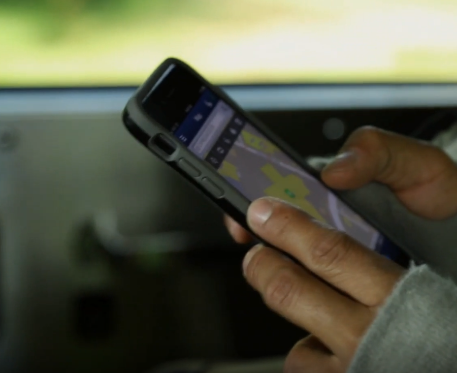
First responders use Responder360 on every major phone, tablet, and PC.

First responders use Responder360 on every major phone, tablet, and PC.

Responder360 boasts an interactive map that enables
first responders to respond and manage incidents with improved:
Pre-Incident Planning
Incident Response
Command Support
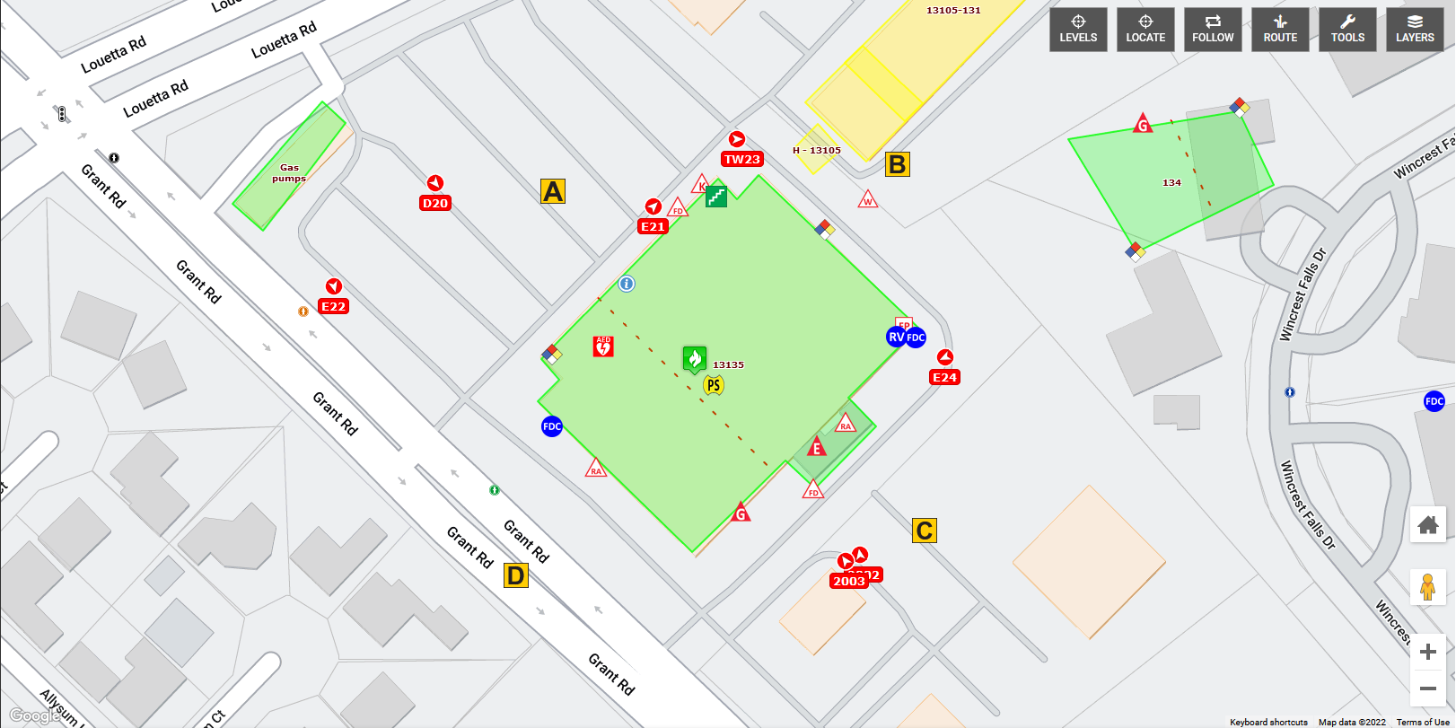
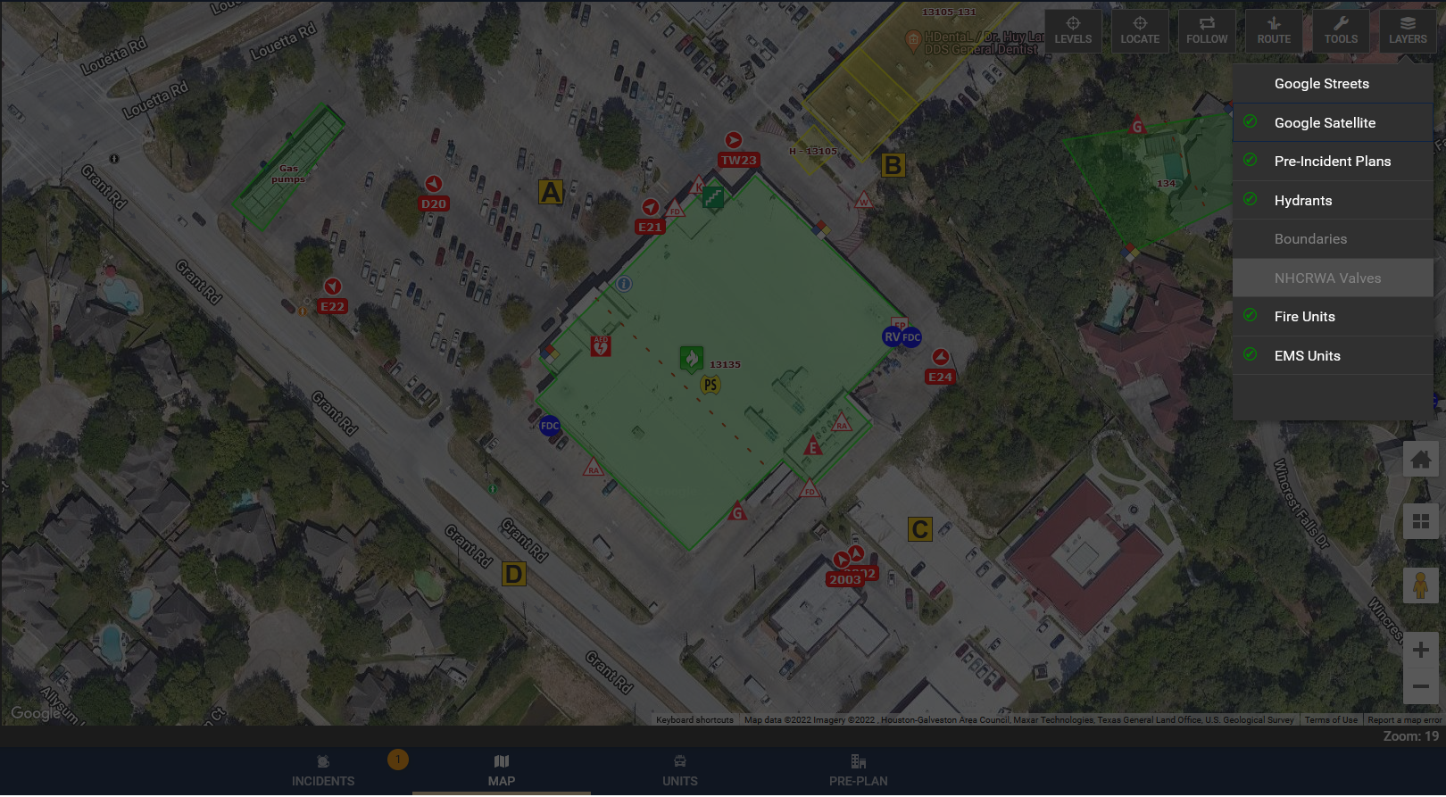
Responder360 offers total pre-incident plan management compliant with NFPA 1620. All occupancy data related to construction details, operational systems, protection features, contacts and access information can be noted and available for easy access in the field! Quickly upload a sketch or building plan and place NFPA 170 and other symbols directly on any map layer to view while responding. As soon as the data is saved in the system, it is immediately available to all users.
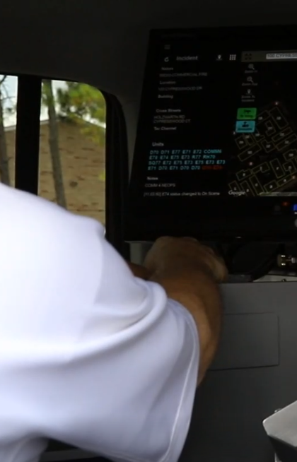
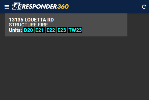
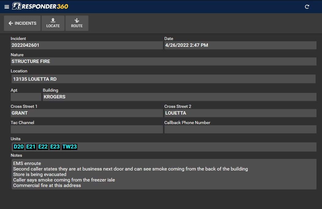
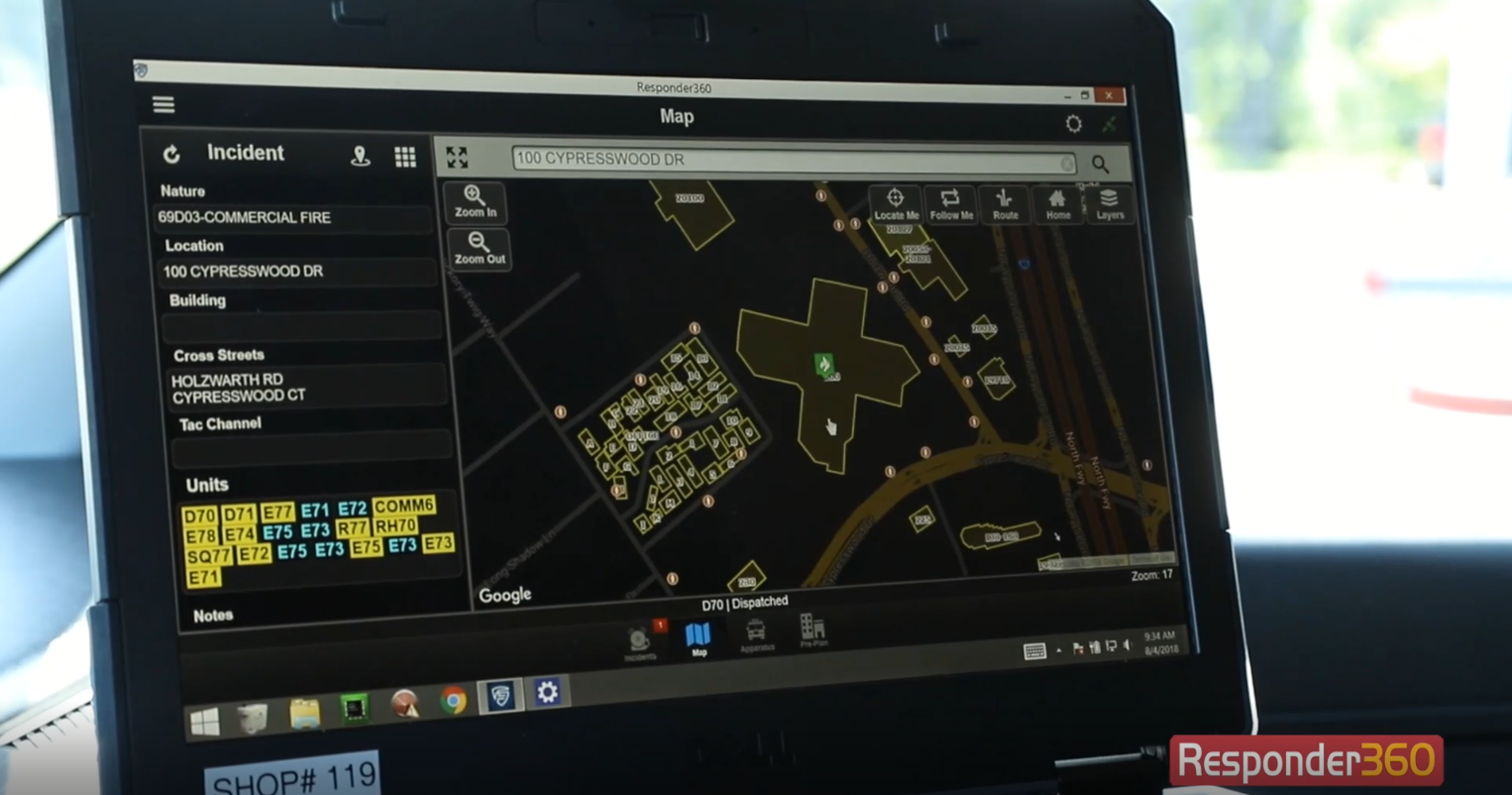
Integration with your CAD system provides responders with a real-time response dashboard that displays incident notifications. When responders open a call, they have access to incident details and notes, location and routing services, as well as pre-plan information associated with occupancy records at incident locations. When supported by your CAD system, available two-way unit statusing allows responding units to feed their times to your dispatchers with a push of a button.
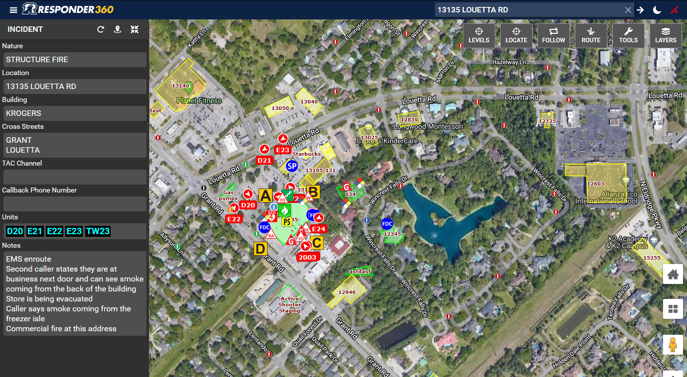
The Responder360 field application allows incident commanders to visualize all of the aggregated pre-plan, incident and AVL information for both their own department and any neighboring jurisdictions sharing information with them. Having real-time information associated with the hazards and features of an occupancy plus the physical location and travel details of responding units combined provides the optimal platform for making critical strategic decisions and tactical assignments.
Responder360 boasts an interactive map that enables first responders to respond and manage incidents with improved:
Pre-Incident Planning
Incident Response
Command Support
Responder360 offers total pre-incident plan management compliant with NFPA 1620. All occupancy data related to construction details, operational systems, protection features, contacts and access information can be noted and available for easy access in the field! Quickly upload a sketch or building plan and place NFPA 170 and other symbols directly on any map layer to view while responding. As soon as the data is saved in the system, it is immediately available to all users.
Integration with your CAD system provides responders with a real-time response dashboard that displays incident notifications. When responders open a call, they have access to incident details and notes, location and routing services, as well as pre-plan information associated with occupancy records at incident locations. When supported by your CAD system, available two-way unit statusing allows responding units to feed their times to your dispatchers with a push of a button.
The Responder360 field application allows incident commanders to visualize all of the aggregated pre-plan, incident and AVL information for both their own department and any neighboring jurisdictions sharing information with them. Having real-time information associated with the hazards and features of an occupancy plus the physical location and travel details of responding units combined provides the optimal platform for making critical strategic decisions and tactical assignments.
Explore the features of Responder360
Responder360 is the complete incident response system for first responders that runs on any device. The “all-in-one” interface enables users to quickly and easily find dispatched locations, view incident data, pre-plans, hydrant locations, other responding apparatus,
and much more!
CAD Integration
Receive real-time data feeds from any CAD system

Mapping Layers
Create, access, and view your pre-plans on any map layer

Incident Location & Routing
Locate and route to incidents on the map using real-time GPS location
GPS Tracking / AVL
Locate and view all of your units on our AVL map 24/7

Interoperability
Share data with your neighboring departments for mutual and auto-aid responses

Occupancy Records
Access complete, detailed information about any occupancy from the responder map

Incident Management
Easily transition from response to incident management

Hydrant Management
Identify your water supply resources at a glance
Explore the features of Responder360
Responder360 is the complete incident response system for first responders that runs on any device. The “all-in-one” interface enables users to quickly and easily find dispatched locations, view incident data, pre-plans, hydrant locations, other responding apparatus,
and much more!

CAD Integration
Receive real-time data feeds from any CAD system

Mapping Layers
Create, access, and view your pre-plans on any map layer

Incident Location & Routing
Locate and route to incidents on the map using real-time GPS location
GPS Tracking / AVL
Locate and view all of your units on our AVL map 24/7

Interoperability
Share data with your neighboring departments for mutual and auto-aid responses

Occupancy Records
Access complete, detailed information about any occupancy from the responder map

Incident Management
Easily transition from response to incident management

Hydrant Management
Identify your water supply resources at a glance
REPLACE YOUR TRADITIONAL CLUNKY MDC SOFTWARE!
Imagine when first responders are dispatched…
Crews can quickly and easily find dispatched locations and view pre-incident plans while en route to an incident along with hydrants, hazmat, and other data regardless of jurisdictional boundaries.
Incident Commanders can quickly make tactical decisions by visually seeing real-time locations of responding apparatus, satellite imagery, hydrant locations, and pre-incident plans. All at the touch of a finger!
News
HEAR WHAT PEOPLE ARE SAYING ABOUT FIRST IN SOFTWARE
WE’D LOVE TO HEAR FROM YOU
To request a demo or inquire about sales, training, or other professional services, contact us today!
Sq. Miles Mapped:
Population Served:
Annual Call Volume:
System Users:
Incident Location & Routing
Quickly locate and route to incidents on the responder map using real-time GPS location to help you arrive on scene faster and more efficiently. With the Responder360 flexible viewing modes, you can view your units AVL location on a static map or set the map to follow your unit as you travel.
Optional available features include pop-out controls for turn-by-turn directions through the interface of your choice.

Mapping Layers
Our default responder map includes map view, street view and satellite view options with your preplan information overlaying them. As a standard feature of the Responder360 system, you can use custom map layers and ESRI shape-files such as boundaries, hazards, and other points of interest as optional overlays on the map and users can toggle them on/off as needed.

CAD Integration
Real-time integration with your dispatch agencies CAD system is a standard feature of Responder360, provided at no extra cost. We can take data from the simplest Email Notifications to full database replication services and give you the most recent incident information including notes and unit status.
Two-way unit status updating with your CAD is an available option with participating CAD software systems.

GPS Tracking / AVL
Keeping track of all of your resources is easy with our interactive responder map which tracks GPS coordinates of all units and displays station locations 24/7 so you can be situationally aware at all times.

Interoperability
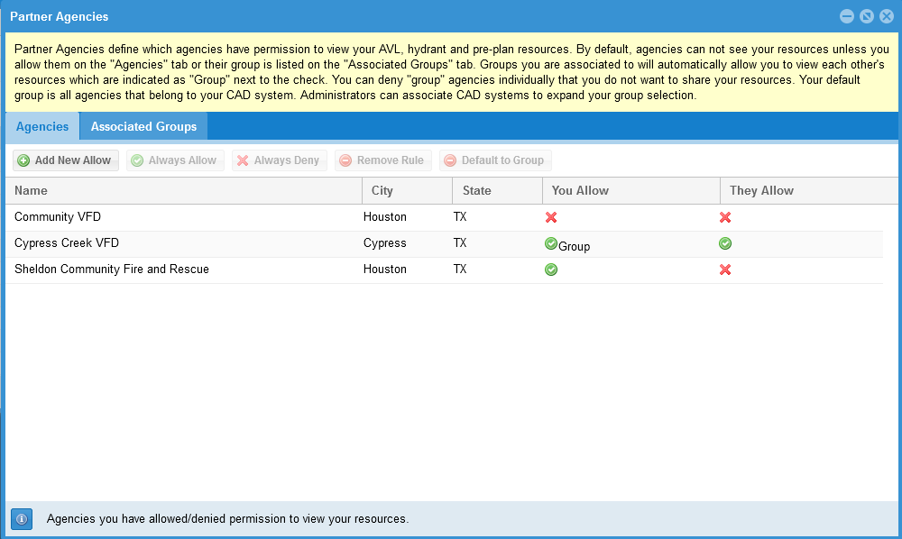
Administrative data-sharing controls allow you to automatically share with your neighboring departments and view each other’s unit locations, pre-plans, and hydrants. This is ideal for departments with local aid agreements and over-lapping borders with surrounding agencies.
Data sharing can also be turned on temporarily for deployments to remote areas during disasters or large-scale incidents.

Occupancy Records
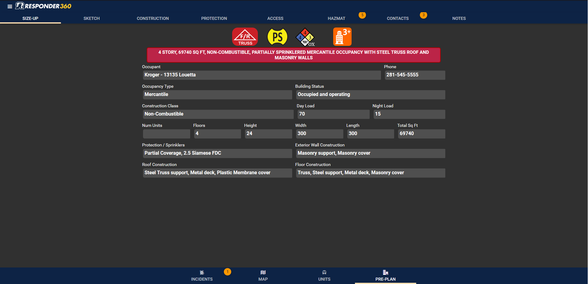
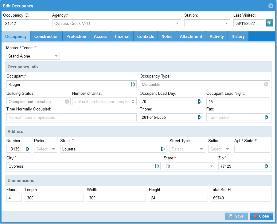
Creating an occupancy record for any location generates a visually identifiable building shape on the responder map, which is used to access pre-plan data and sketches. NFPA 170 symbols can be added directly to the pre-plan map to quickly identify access points, building features, hazards, and protection system information. The occupancy records contain detailed information about each location, including a Size-Up page that quickly alerts responders of hazards such as truss roofs or hazardous chemicals, with DOT and NFPA 704 identifiers.

Incident Management
Once on scene, utilizing the integrated features of Responder360 allows you to transition from response to incident management. Occupancy size-up and pre-plan details combined with unit response information gives incident commanders a real-time view of the dynamic incident scene, allowing them to make informed decisions on how to address incident concerns.

Hydrant Management
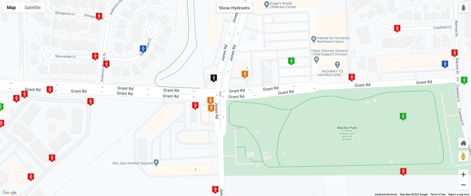
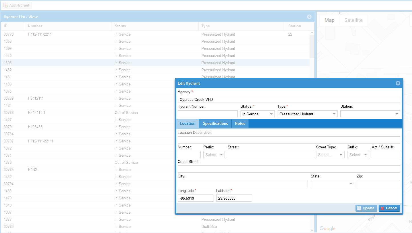
View hydrants and draft sites on the responder map, color coded based on flow rates in accordance with NFPA standards. Click or touch any hydrant to view size, flow rates, pressure, last inspection date and status. Out of service hydrants are automatically identified on the map.
Users can easily add and edit hydrants within the system or import your hydrant information from existing data sources.


